
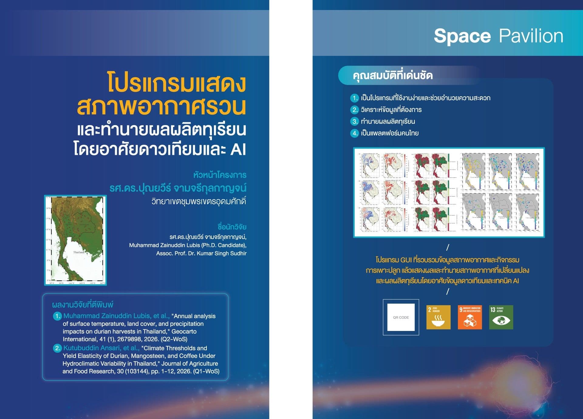
The presented GUI program is designed to display irregular weather conditions and predict durian yields using satellite data and artificial intelligence. It integrates satellite-based environmental monitoring, geospatial analysis, and AI-driven prediction with ground-based measurements, geospatial intelligence, environmental analytics, and machine learning. This integration supports scientific research, environmental monitoring, climate assessment, and data-driven decision-making. The GUI program provides analytical and predictive information based on datasets, algorithms, models, and parameters selected by the user. Predictions, classifications, and analytical results should be interpreted as model-based information, not as substitutes for professional judgment, field observations, official measurements, or regulatory information. Accuracy may vary depending on data quality, spatial and temporal resolution, model configuration, input variables, geographic conditions, and other analytical assumptions. Users are responsible for validating analytical results before applying them to operational, scientific, commercial, regulatory, or policy-related decisions.
การเปลี่ยนแปลงสภาพภูมิอากาศและความแปรปรวนของสภาพอากาศในปัจจุบันส่งผลกระทบโดยตรงต่อภาคการเกษตร โดยเฉพาะทุเรียนซึ่งเป็นผลไม้เศรษฐกิจสำคัญของประเทศไทย การผลิตทุเรียนมีความอ่อนไหวต่อปัจจัยด้านสิ่งแวดล้อม เช่น ปริมาณน้ำฝน อุณหภูมิ ความชื้น และสภาพดิน การขาดข้อมูลที่แม่นยำและทันสมัยทำให้เกษตรกรและผู้เกี่ยวข้องไม่สามารถวางแผนการผลิตได้อย่างมีประสิทธิภาพ จึงเกิดความจำเป็นในการพัฒนาเครื่องมือที่สามารถรวบรวม วิเคราะห์ และพยากรณ์ข้อมูลด้านสิ่งแวดล้อมและผลผลิตได้อย่างเป็นระบบ โปรแกรม GUI ที่นำเสนอจึงถูกพัฒนาขึ้นเพื่อเป็นแพลตฟอร์มที่บูรณาการข้อมูลจากหลายแหล่ง ทั้งข้อมูลดาวเทียม ข้อมูลภาคพื้นดิน ข่าวกรองเชิงพื้นที่ และการวิเคราะห์สิ่งแวดล้อม โดยใช้เทคโนโลยีปัญญาประดิษฐ์และการเรียนรู้ของเครื่องเข้ามาช่วยเพิ่มความแม่นยำในการวิเคราะห์และการพยากรณ์ โปรแกรมนี้ไม่เพียงแต่ช่วยให้ผู้ใช้สามารถเข้าถึงข้อมูลเชิงวิเคราะห์ได้สะดวก แต่ยังเป็นเครื่องมือที่สนับสนุนการวิจัยทางวิทยาศาสตร์ การติดตามสิ่งแวดล้อม และการประเมินสภาพภูมิอากาศในเชิงลึก ที่มาของการพัฒนาโปรแกรมนี้เกิดจากความต้องการในการสร้างระบบที่สามารถเชื่อมโยงข้อมูลเชิงพื้นที่และข้อมูลสิ่งแวดล้อมเข้ากับการตัดสินใจเชิงข้อมูล เพื่อให้ผู้ใช้สามารถใช้ผลการวิเคราะห์และการพยากรณ์เป็นแนวทางในการจัดการผลผลิต วางแผนการตลาด และกำหนดนโยบายที่เกี่ยวข้องกับการเกษตรและสิ่งแวดล้อมได้อย่างมีประสิทธิภาพ นอกจากนี้ โปรแกรมยังถูกออกแบบให้มีความยืดหยุ่น โดยผู้ใช้สามารถเลือกชุดข้อมูล อัลกอริทึม แบบจำลอง และพารามิเตอร์ที่เหมาะสมกับบริบทของตนเอง ทำให้ผลการวิเคราะห์มีความเฉพาะเจาะจงและตอบโจทย์การใช้งานที่หลากหลาย
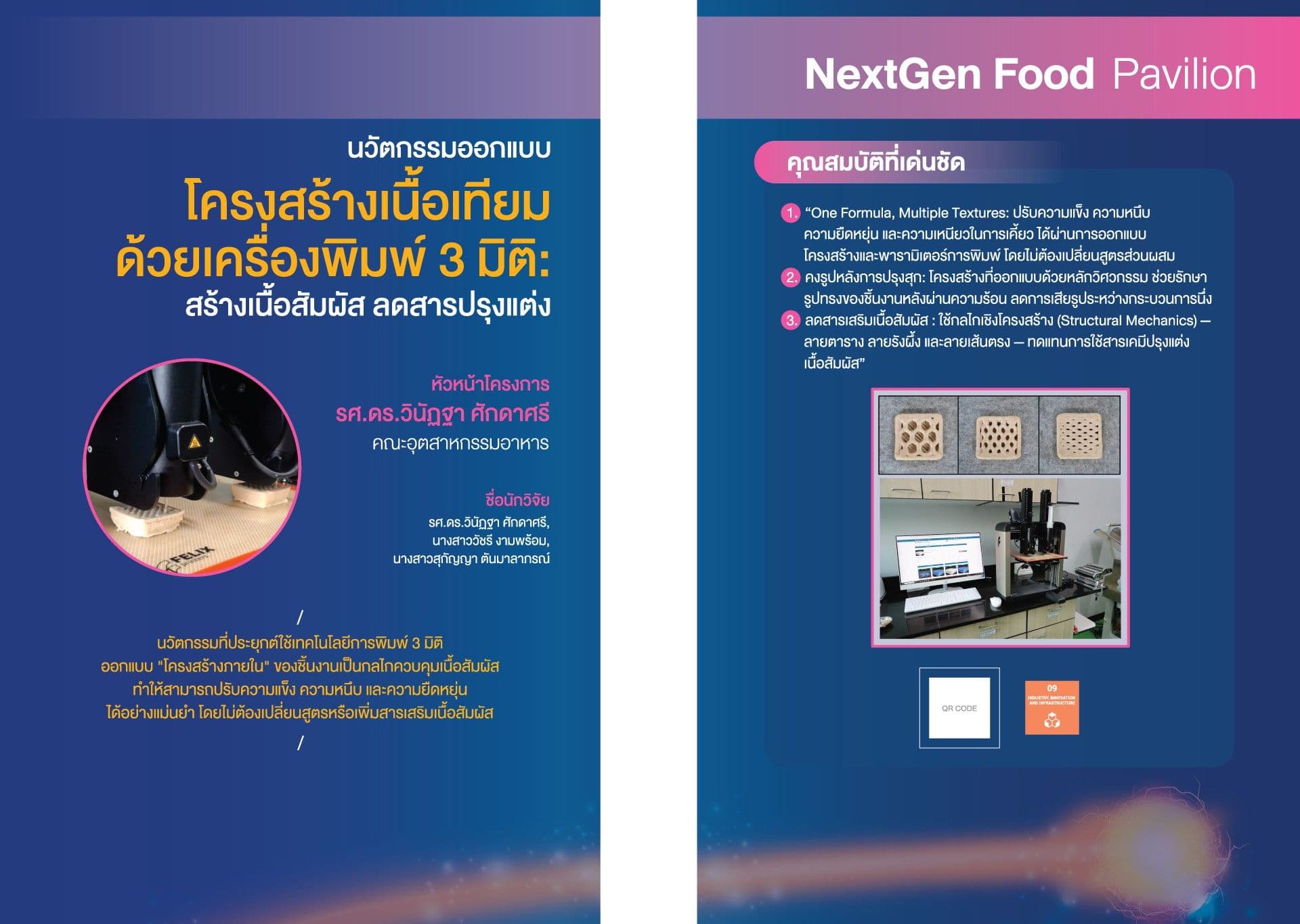
คณะอุตสาหกรรมอาหาร
-

คณะวิทยาศาสตร์
-
วิทยาเขตชุมพรเขตรอุดมศักดิ์
-